访问网址: https://qingmaps.org/
The aim of QingMaps is to create an interactive map analysis and research visualization tool for students and researchers working on Qing history. The current software is still under active development and does not yet feature tools for anyone other than the back-end developers. We hope to receive your input and active involvement on this first milestone to further develop the functionalities of QingMaps.
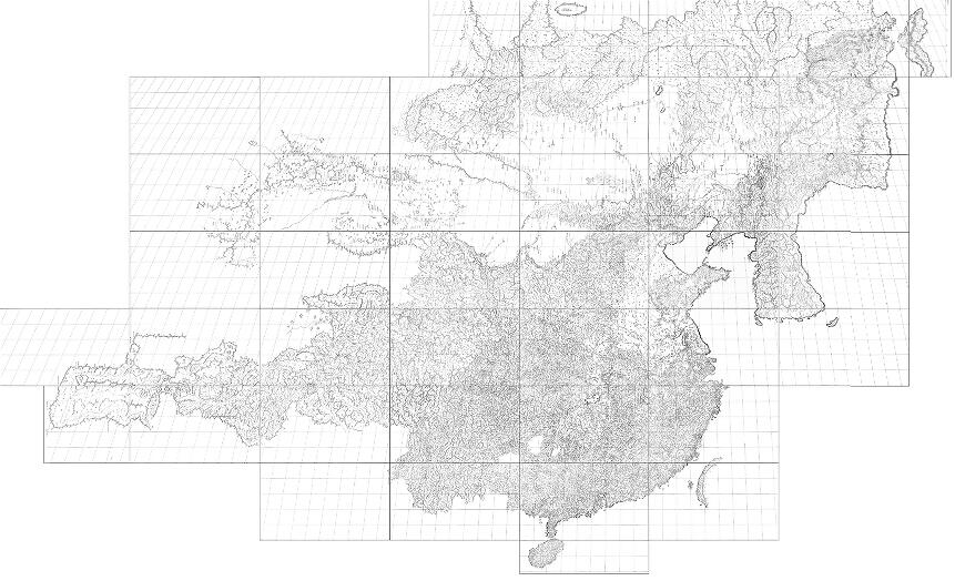
Our first priority is to develop a tool to visualize research findings on a contemporary representation of Qing space. This tool will consist of a fully indexed edition of the Kangxi atlas or 皇輿全覽圖 available to the public. In the future, we will expand the technical capability of QingMaps and include the Yongzheng and Qianlong atlases, and potentially any map representing the Qing realm.
QingMaps was founded by Fresco Sam-Sin and Mario Cams, coded by Léon Rodenburg, and supported by the University of Macau. Additional support comes from the Manchu Foundation, the Hulsewé Wazniewski Foundation, and the Special Collections at Leiden University. Graphic integration of the maps is done by Cecilia Hendrikx. The raw materials for the current version of QingMaps were taken with permission from Wang Qianjin 汪前进& Liu Ruofang 刘若芳, 清廷三大實測全圖集, 3 Vols., Beijing: Waiwen chubanshe, 2007.